Client: GWP Consultants LLP, Environmental Solutions Limited, IWEco
Project title: Consultancy for the Hydrological Assessment of a Wetland Ecosystem, under the Jamaican IWEco national sub-project, Biodiversity Mainstreaming in Coastal Landscapes within the Negril Environmental Protection Area of Jamaica
Location: Jamaica
Date: 2020 – 2022
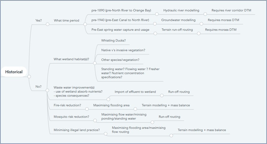
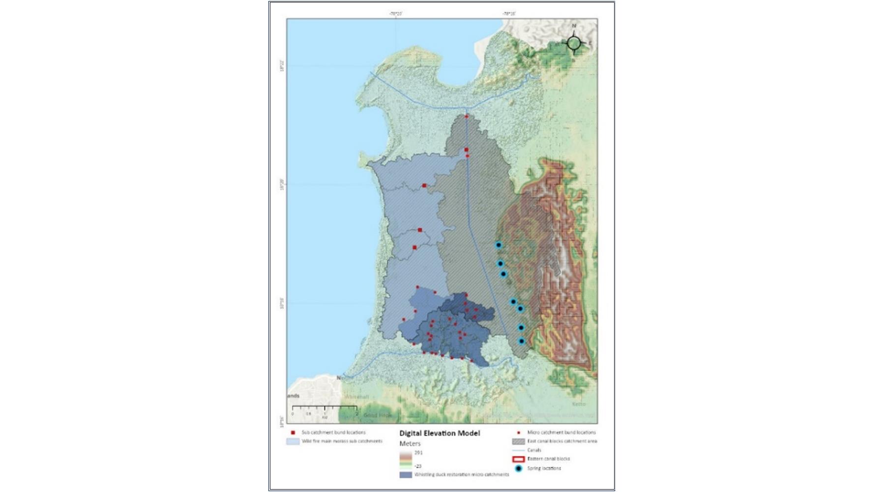
The Integrating Water, Land and Ecosystems Management in Caribbean Small Island Developing States (GEF-IWEco) Project is a multi-focal, regional project that builds upon the work of previous initiatives, to address water, land, and biodiversity resource management, as well as climate change in ten participating countries. As part of Sub-component 1.1 of the Jamaican sub-project, Planning Hydrological Restoration of the Negril Environmental Protection Area, the analysis of historical changes within the Negril Great Morass, the assessment of the current hydrological regime and scenario modelling for rewetting, were required. There were five specific hydrological restoration targets/areas:
- Wild bush fire risk reduction measures.
- West Indian Whistling Duck wetland improvements.
- East canal water level control measures.
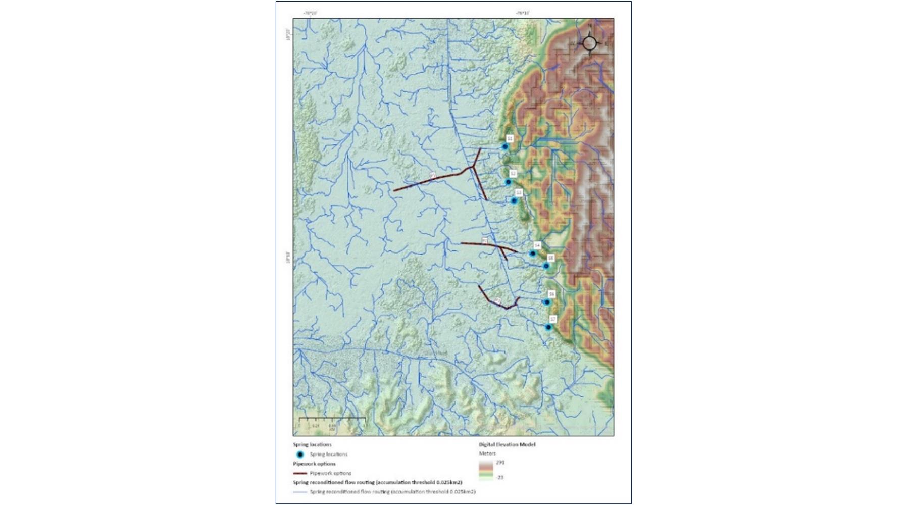
- Eastern spring flow capture measures.
- Wetland Sedimentation control.
- Geospatial Solutions: GIS, Geospatial Data Preparation, Characterization and Analysis
- Water Resources: Hydrogeological Interpretation & Analysis, Geospatial Flood Risk Modelling
- Environmental Science: Visualisation Specialist
- Environmental Data Science: Programmer/App Development
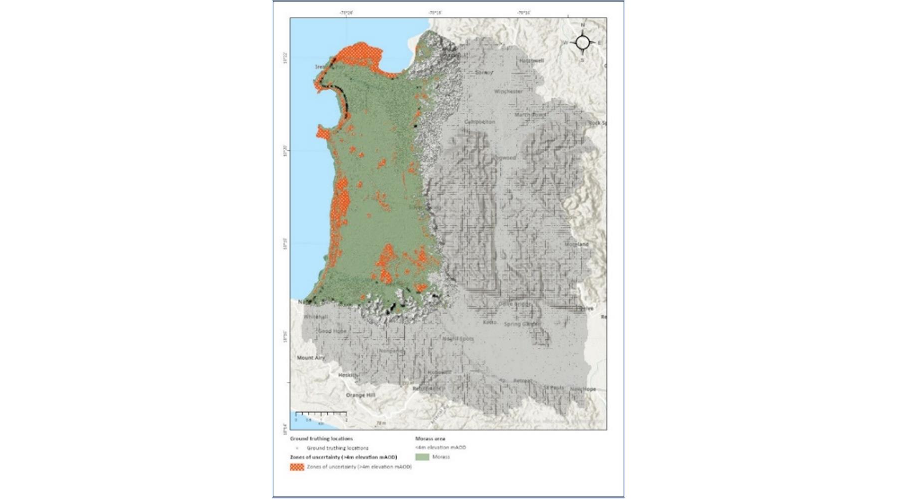
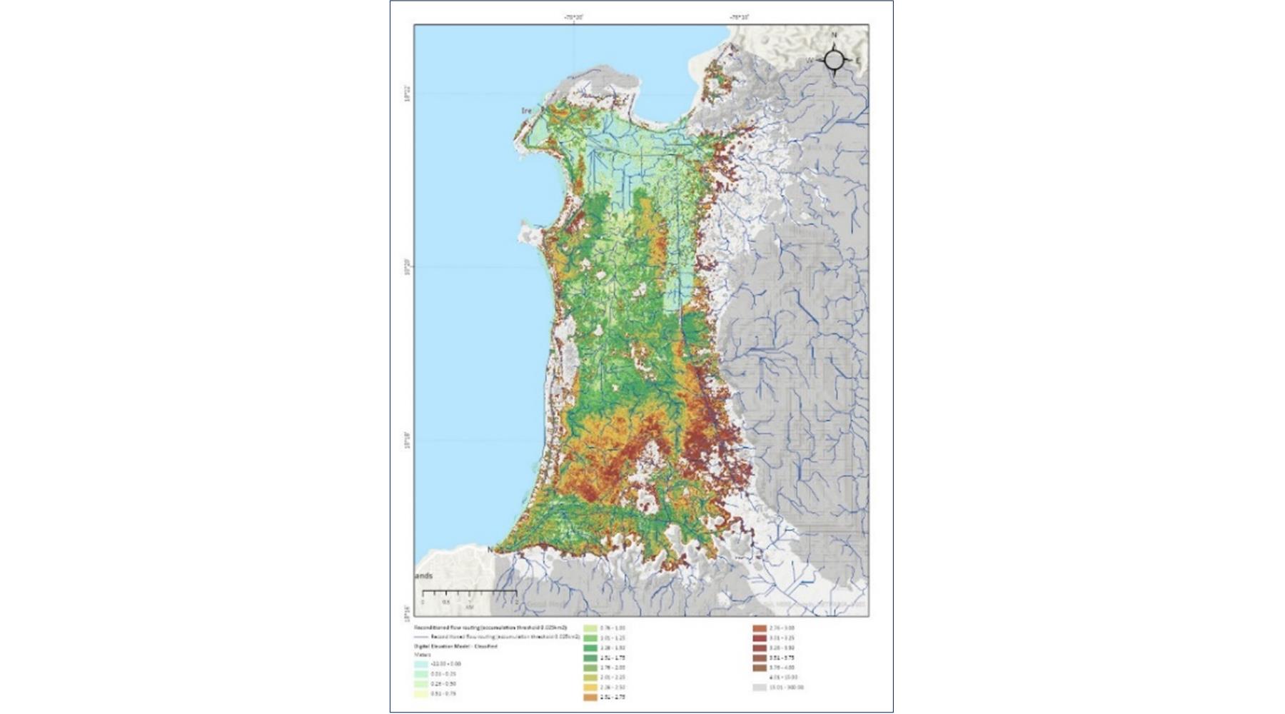
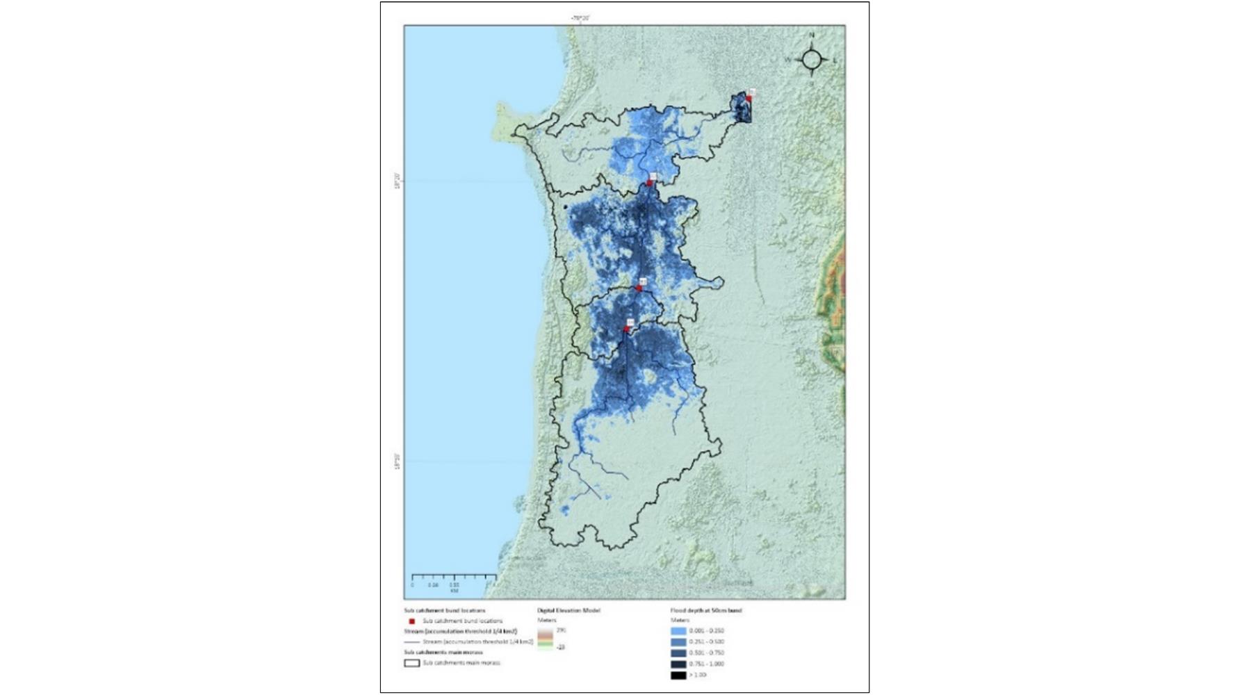
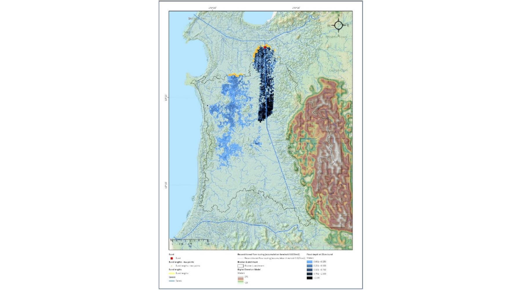
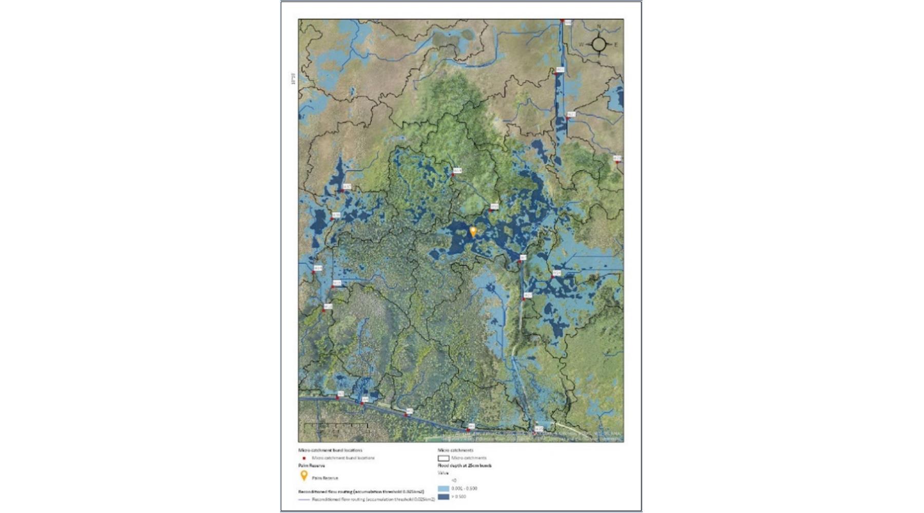
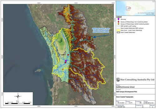
Historical maps of the area were digitized and brought together with auxiliary geospatial meteorological and hydrological data in GIS to support the historical evaluation undertaken by GWP Consultants LLP. The relationship between hydrological restoration objectives and hydrological model selection was explored and geomorphological terrain modelling was deemed the most suitable for the intended objectives. The Digital Elevation Model (DEM) resulting from a Síor project-commissioned survey was zoned into areas considered ‘reliable’ and ‘uncertain’ for modelling predictions, within which rainfall-run-off modelling was completed. A hydrological flow routing analysis utilizing the DEM was undertaken, allowing for the alignments and locations of storm water run-off flows to be identified. Each of the five hydrological restoration targets/areas were then assessed by modelling the hydrological flow and ponding of water in the Morass as a result of introducing various retention structures (bunds) and/or flow blockers of varying heights and locations, as well as routing the eastern groundwater springs further into the centre of the Morass. This analysis ultimately identified the optimum water levels required to deliver the ideal areas and depths of water retention in the wetland for the five restoration targets.