
GROUNDWATER INVESTIGATION AND MANAGEMENT STRATEGY UPDATE FOR SUSTAINABLE MINING OPERATIONS AT GARDEN WELL GOLD MINE
Client: Regis Resources Ltd Location: Garden Well Gold Mine, Duketon Goldfields, Western Australia Date: 2022
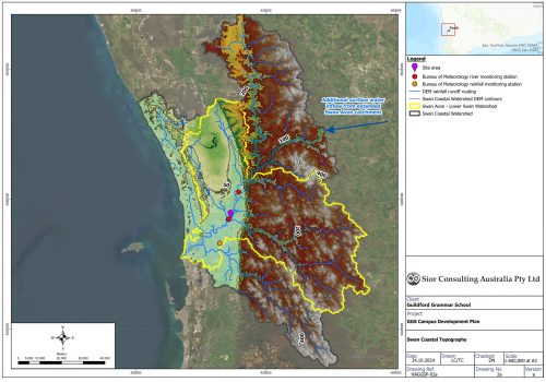
GUILDFORD GRAMMAR SCHOOL CAMPUS MASTER PLAN: HYDROLOGICAL AND GEOTECHNICAL APPRAISAL FOR SUSTAINABLE DEVELOPMENT
Client: Guildford Grammar School Location: Guildford, Western Australia Date: 2024 - on-going
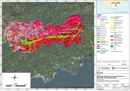
ABP BANDON AWS AUDIT: CATCHMENT ANALYSIS AND WATER USAGE
Client: Anglo Beef Processors (ABP) Food Group Location: Bandon-Ilen Catchment Date: 2021
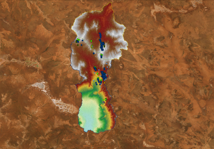
CMM – GROUNDWATER MODELLING AND WATER LEGISLATION MODELLING
Client: Capricorn Metals Ltd Location: Western Australia Date: 2020 - 2021
MGSI – WEARDALE LITHIUM GEOMORPHOLOGICAL GEPSPATIAL CHARACTERISATION
Client: Magnum GSI Location: UK Date: 2022 to on-going
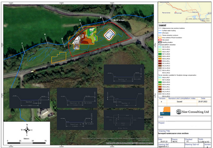
MCGINTY PLANNING & DEVELOPMENT CONSULTANTS – PLANNING APPRAISAL, QUARRY WATER MANAGEMENT
Client: McGinty Planning and Development Consultant’s Location: Ireland Date: 2022
HOLISTIC FLOOD RISK ASSESSMENT RISK MANAGEMENT
Client: Mr A. O'Connell Location: Ireland Date: 2022
EIRGRID GROUP MGSI – FIELD RISK MANAGEMENT HVDC CABLE GROUND DEFORMATION
Client: Magnum GSI Location: Ireland Date: 2021 - 2022
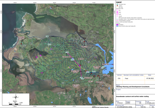
IRISH GROUNDWATER RESOURCE CHARACTERISATION AND DEVELOPMENT
Client: Confidential Location: Ireland Date: 2018 - on-going
REGIS RESOURCES LTD – MINE WATER SOLUTIONS
Client: Regis Resources Ltd Location: Western Australia Date: 2021 - on-going
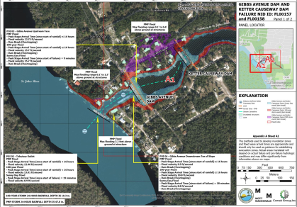
FLORIDA DAM MODELLING
Client: Comak Group Inc (CGI) & Florida Department of Environmental Protection (FDEP) Location: Florida, USA Date: 2018 – ongoing
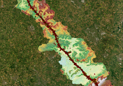
HIGH SPEED 2 (HS2) RAILWAY
Client: GWP Consultants LLP Location: UK Date: 2021 – ongoing