
Welcome to Síor Consulting
Hello world, Síor Consulting is in full swing 🙂, and it’s time we start sharing our experiences and ideas with the GIS community… and the world at large. Here, in our blog section, we’ll start with a series of posts…
Hello world, Síor Consulting is in full swing 🙂, and it’s time we start sharing our experiences and ideas with the GIS community… and the world at large. Here, in our blog section, we’ll start with a series of posts…
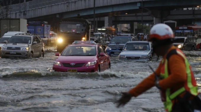
Explore subsidence and urban development in Bangkok through Síor Consulting Ltd's interactive Story Map. Examine the changing landscape, delve into the complexities of land cover analysis, and gain insights into the dynamic land subsidence challenges facing the city.
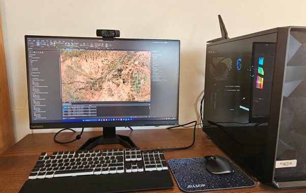
In the fast-paced world of big data, geoscientific consultancies like Síor face the colossal challenge of processing vast amounts of information efficiently. Being tech-savvy is no longer an option, it is now become a necessity. Custom workstations equipped with the…
Introduction This blog will form part of a mini-series that aims to dissect the intimate relationship between ISO and consultancy operations. In today’s competitive business landscape, organisations strive to distinguish themselves by adhering to international standards that demonstrate their commitment…
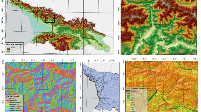
Animation depicts high elevations in red and lower elevations in blue and green
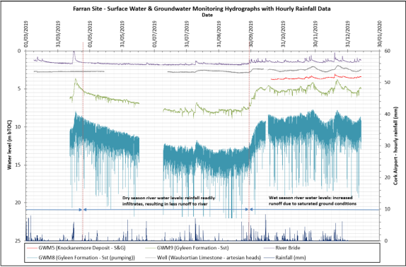
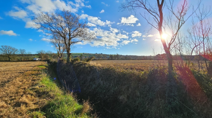
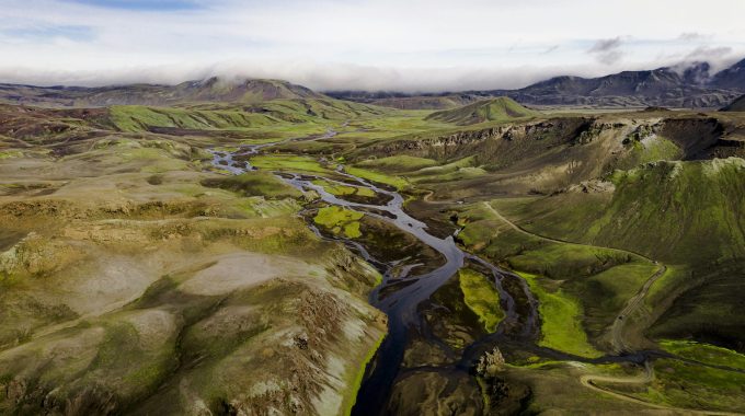
Water Monitoring is a key component of water resource management. In this blog explores how monitoring programs are implemented to characterise baseline conditions and any changes over time.
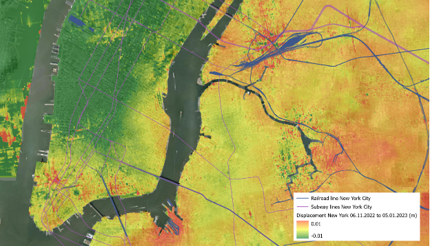
Monitoring Ground Movement Using Radar and Interferometry Images: A Case Study of New York 2023 Land subsidence in New York Introduction Geospatial technologies are changing our understanding of Earth and land surface movements. Among the most advanced tools are…
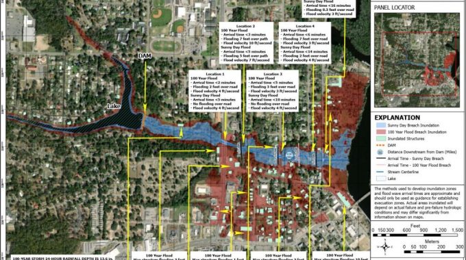
In a world of frequent natural disasters, having reliable Early Warning Systems is a necessity, not a privilege.
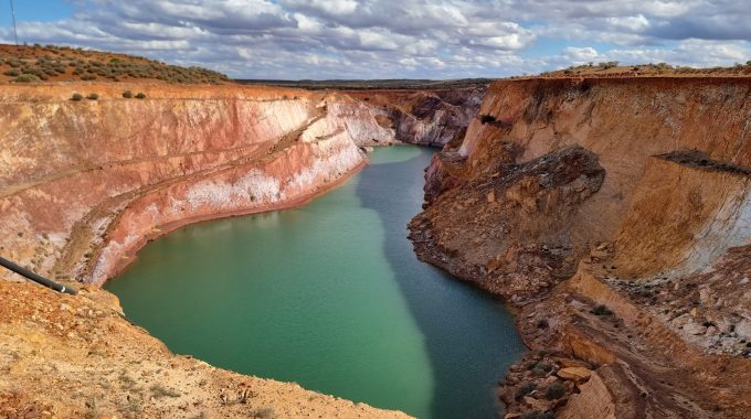
Gold mining is a multi-billion-dollar industry. But where does gold come from, how is it mined and how can we ensure that its extraction does not negatively impact our most valuable resource – water?
As we approach our 5th birthday, we have outlined our ambitions for the years to come.
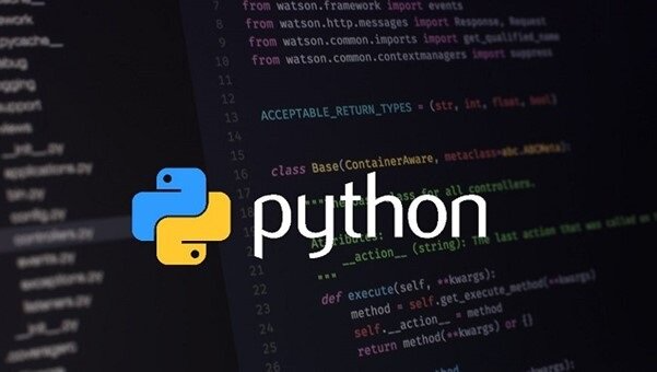
In the realm of geoscience, the use of technology has reshaped the landscape of exploration, analysis, and interpretation. Among the many tools available, Python emerges as a game-changer, offering a versatile and powerful means to manipulate, analyse, and visualise geological data.
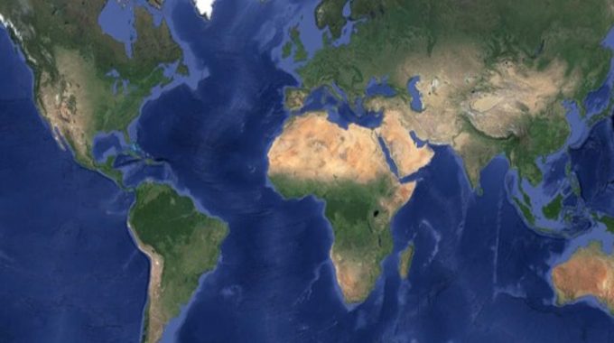
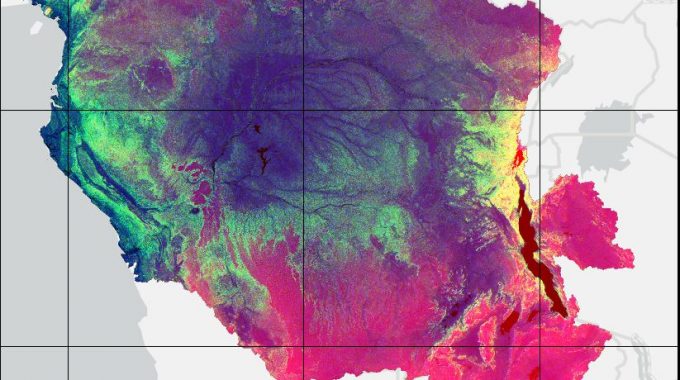
What is Google Earth Engine? Google Earth Engine (GEE) is a cloud-based platform that allows scientists and researchers to access peta-bytes (1 peta-byte is a 1000 terabytes) of satellite imagery and geospatial data. It provides users with advanced geospatial analytical…
Remote sensing: The process of detecting and monitoring the physical characteristics of an area by measuring its reflected and emitted radiation at a distance, typically from satellite or aircraft (USGS, 2021). In short, collecting information from a distance. Through measuring…
Ever wondered what our approach is to project completion and delivery? Wondering how we can achieve exactly what a customer wants whilst still maintaining an innovative and technically sound approach underpinned by a solid ethos of efficiency and precision? Want…
You will undoubtedly have had more exposure to machine learning than perhaps you realised; from Alexa and Siri, journey planning and fraud detection. Machine learning is fast becoming a major part of modern day living, contributing to the ease of…
GIS = Geographic Information Systems Spatial Data Layers, Source: ESRI Everything happens somewhere, providing a wealth of potential location data. The geospatial data realm has progressed considerably in the last 50 years. Progressing from basic maps and photos to geodatabases…
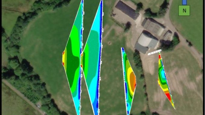
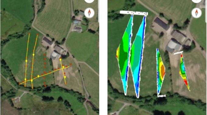
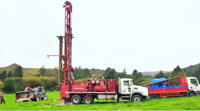
Now, it’s time to get a little more personal. If you have been following this multipart series of blogs which describes “A Multidisciplinary Approach”, you will have been eagerly anticipating the release of this next part on Electrical Resistivity Tomography…
As a community of environmental, GIS, and computing professionals, all of us at Síor Consulting have been exposed to very different professional environments, challenges and also computer systems – software and hardware – throughout our careers in our respective fields…
At Síor Consulting, we aim to build a community of people who thrive as individuals, but also as part of a larger team, each bringing their own unique skillset from their respective disciplines for others to learn from. This idea…
Across the globe, Síor Consulting Ltd (SCL) provides tailored GIS services and solutions for clients. One of our first clients was Comak Group, Inc. (CGI). Michael Cox, CGI’s Director and now a close friend of Síor’s, recognises the importance of…

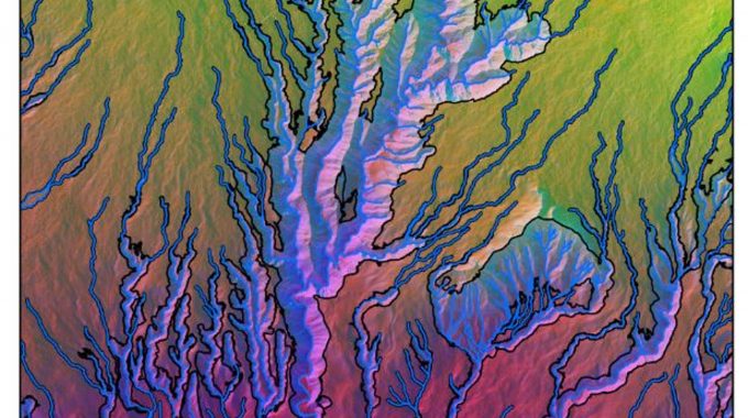
I have always been fascinated by the worlds of environmental sciences and data visualisation; mixing both in my professional career was a no-brainer! In this modern era, data-driven environmental studies are unravelling a truly exciting and innovative digital universe, which…