
Monitoring Ground Movement Using Radar and Interferometry Images: A Case Study of New York 2023…
Applications of InSAR – A Remote Sensing Technique
What is InSAR?
This blog will form part of a mini-series that aims to dissect the intimate relationship InSAR and environmental intelligence.
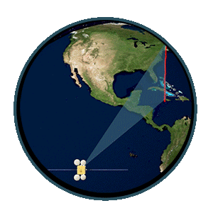
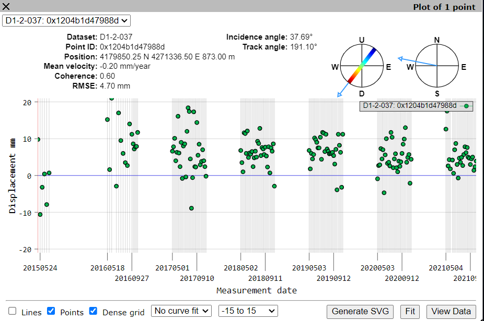
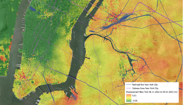
InSAR stands for Interferometric Synthetic Aperture Radar; a remote sensing satellite technique that detects ground deformation. Any change in ground level that has occurred, over a frequency of 12 days – the satellite orbit time – can be mapped as an interferogram. Interferograms are created by layering the Synthetic Aperture Radar (SAR) images over each other.
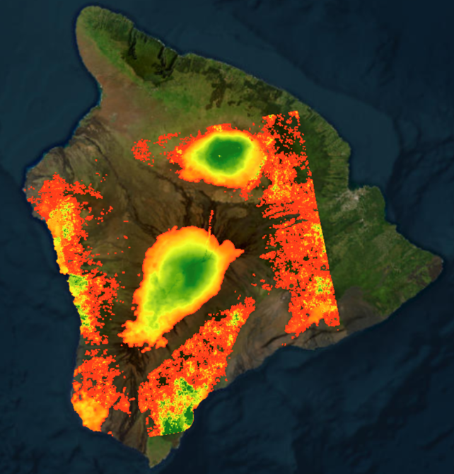
Interferogram of Maui, Hawai’i, created by Síor Consulting Ltd.
Applications
The applications of InSAR are diverse when it comes to operations such as mining and groundwater abstraction, and managing the knock-on effects and impacts that these industries can cause.
InSAR can provide valuable insights into the dynamics of hydrological and hydrogeological systems, which can help to better manage water resources and mitigate the impacts of natural hazards.
Alongside other information (i.e., landcover, DEMs, etc), InSAR enables governments and companies to make plans, such as:
Evacuation plans – geohazards.
Risk assessment planning – for health and safety in commercial works.
Urban planning – ground stability assessments.
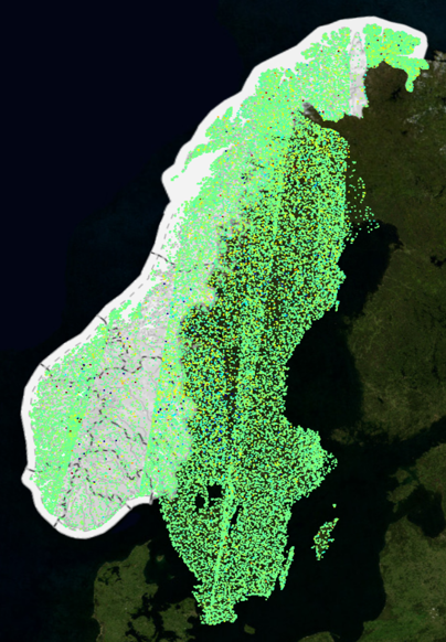
Interferogram of Norway (https://insar.ngu.no)
InSar Norway – service available freely for the public to view subsidence and landslide risk nationwide (https://insar.ngu.no/)
If you have any questions regarding access to our Hub, products or services, please reach out to enquiries@siorconsulting.com. Please explore our website and feel free to communicate work and research opportunities; Síor Consulting welcomes open collaboration.
Related Posts
Comments (0)