Client: McGinty Planning and Development Consultant’s
Location: Ireland
Date: 2022
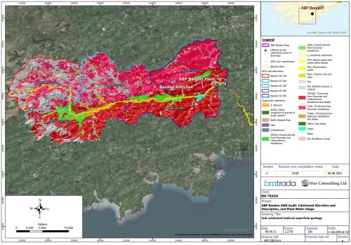
Síor Consulting Ltd. (Síor) was approached by McGinty Planning and Development Consultant’s (McGinty) to provide comprehensive hydrological, hydrogeological, and geospatial consulting services to appraise a quarry planning application in Ireland.
The impact human activities have on the environment has becoming an increasingly discussed topic in recent years. As we continue to develop our world, it is imperative that we work to understand and mitigate the impacts our activities have on the environment.
Síor’s responsibilities included:
- Assessment and analysis of publicly available data, and previously collected data provided by McGinty.
- Characterisation of relevant hydrological and hydrogeological regimes.
- Delivery of geoscientific insights.
Síor leveraged our combined geoscientific expertise to:
- Execute a comprehensive, data-driven, top-down, geospatial analysis to inform geoscientific insights.
- Develop and refine hydrological and hydrogeological models.
- Prepare and manage geospatial data, culminating in the development of a bespoke web app.
- Preparation of detailed hydrological and hydrogeological appraisal (HAR) report.


