Client: Comak Group Inc (CGI) & Florida Department of Environmental Protection (FDEP)
Location: Florida, USA
Date: 2018 – ongoing
Comak Group Inc. (CGI) contracted Síor Consulting Ltd. (Síor) to collaborate on the development of hydrological and hydraulic modeling efforts across the state of Florida. The work enables the Florida Department of Environmental Protection (FDEP) to better understand the flood risks and extent associated with dam break scenarios for high-hazard potential dams.
This initiative aims to safeguard property, prevent loss of life, and support the development and maintenance of effective Emergency Action Plans (EAPs) to manage these risks. With over ten dams successfully assessed to date, the project is well underway.
Síor’s involvement in the project continues to be geospatially focused in response to the following requirements:
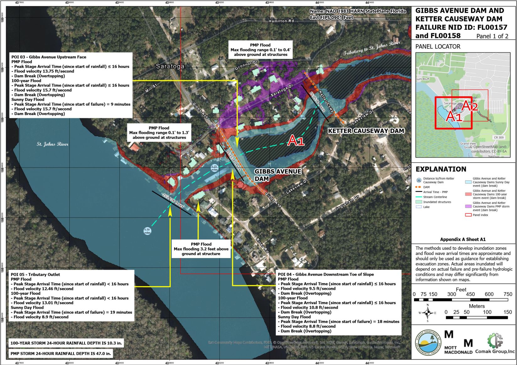
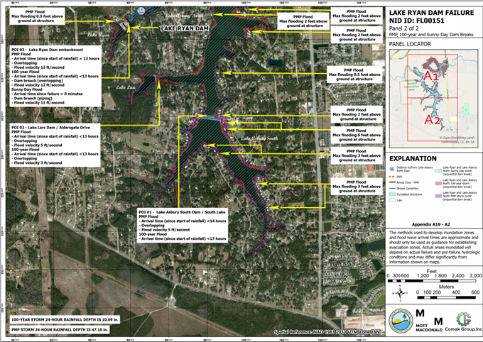
- Providing Hydrologic Engineering Center – Hydrologic Modelling System (HEC-HMS) and Hydrologic Engineering Center – River Analysis System (HEC-RAS) expertise for dam break modelling projects as part of the Florida National Dam Safety Program (FDSP).
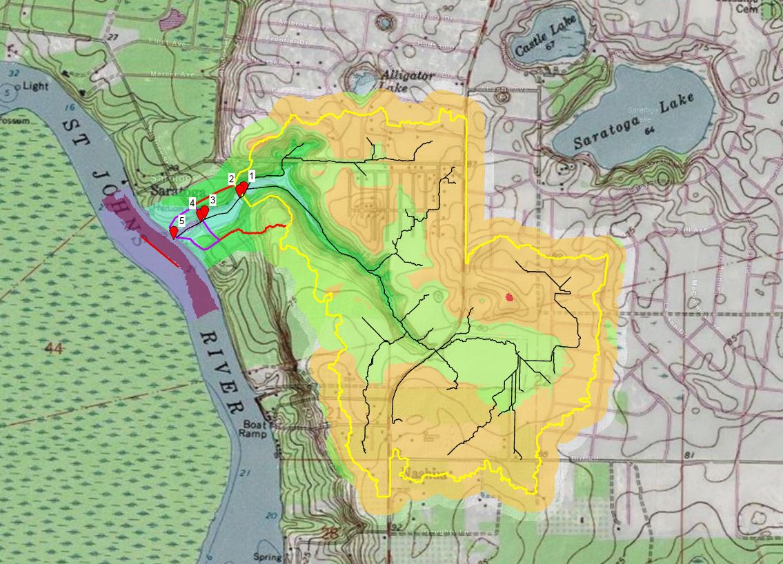
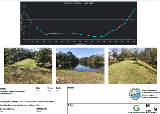
- Conducting inundation mapping and developing Emergency Action Plans (EAPs) for several high-hazard potential dams, supported by the Florida National Dam Safety Program Grant.
- Managing and maintaining geospatial databases.
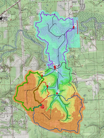
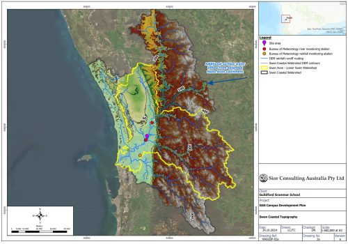
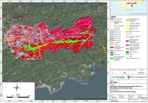
- Performing numerical modelling using a variety of satellite-derived data products, including Digital Elevation Models (DEMs), hydrological characterisation, and spatially and temporally distributed hydrological parameterization models.
The project required the development and implementation of the following geoscientific and information technology components:
- Development of bespoke, semi-automated geospatial solutions, supported by ground observations, tailored to enhance FDSP project outcomes.
- Sourcing county-scale LiDAR-derived Digital Terrain Models (DEMs) for detailed hydrological characterization and scenario modeling.
- Creation of a seamless combined DEM-BEM (Bathymetric Elevation Model) for integration into HEC-HMS and HEC-RAS modeling.
- Streamlining geospatial data workflows, including geodatabase creation and management, drawing production, and data visualisation.
- Development of information technology for geospatial drawing production and enhanced data visualisations.