Client: GWP Consultants LLP
Location: UK
Date: 2021 – ongoing
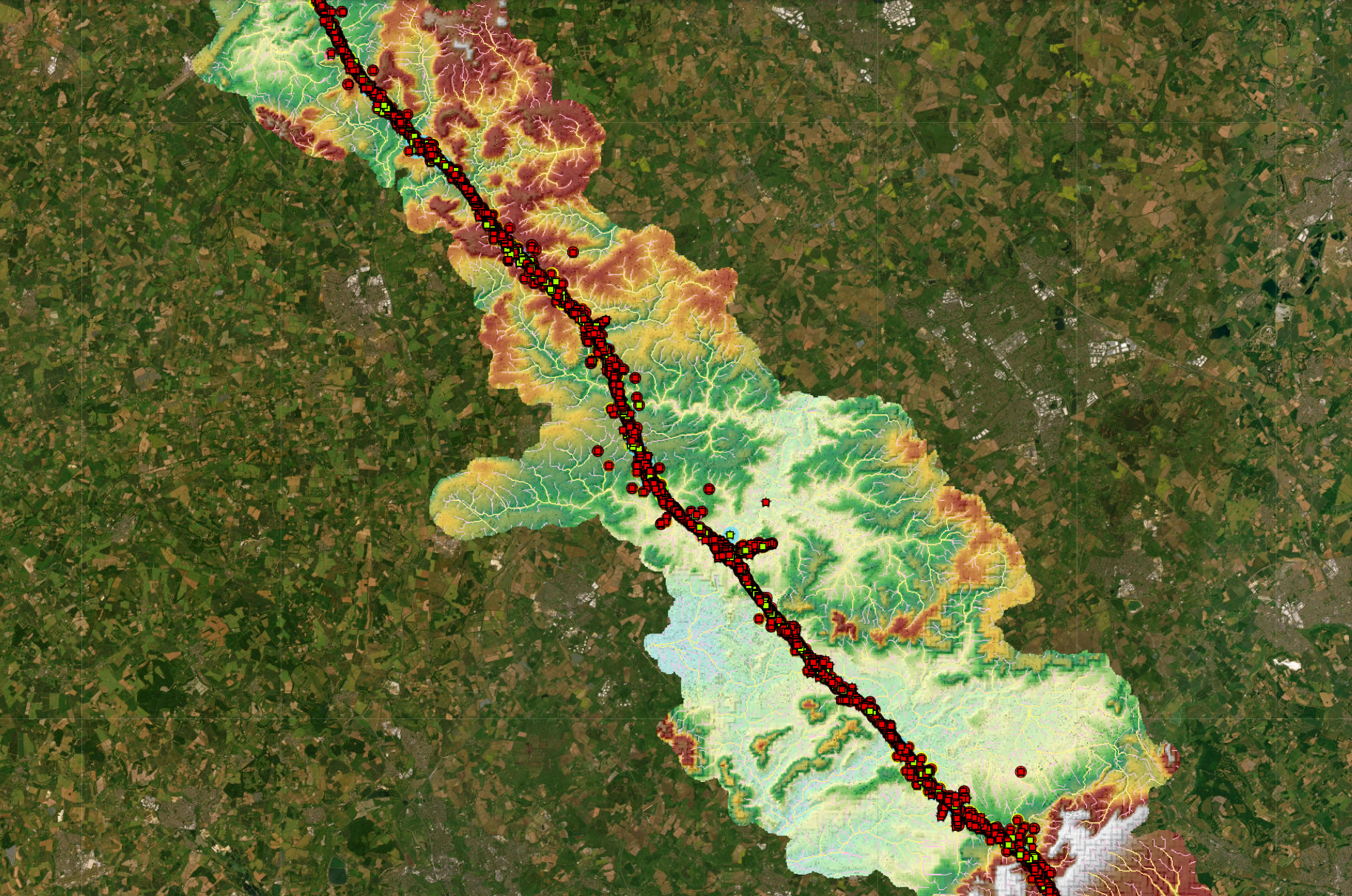
Síor Consulting Ltd. (Síor) was commissioned to provide geoscientific expertise through bespoke IT-enriched geospatial solutions for the High Speed 2 (HS2) project. The HS2 project is a landmark railway infrastructure initiative in the UK, designed to enhance rail capacity and connectivity between Britain’s major urban centers, while alleviating transportation congestion.
Síor continues to play a pivotal role in supporting the development of the railway by ensuring compliance with Schedule 33—project-specific protective provisions—and developing specialised web applications, including the Hydrology Data Web App and the Field Data Collection App.
The complexity of project-specific requirements and regulatory limitations necessitated expert geoscientific and geospatial analysis. For the HS2 project, the client commissioned Síor’s expertise to address a range of geoscientific, geospatial, and information technology disciplines, formulated into the following requirements:
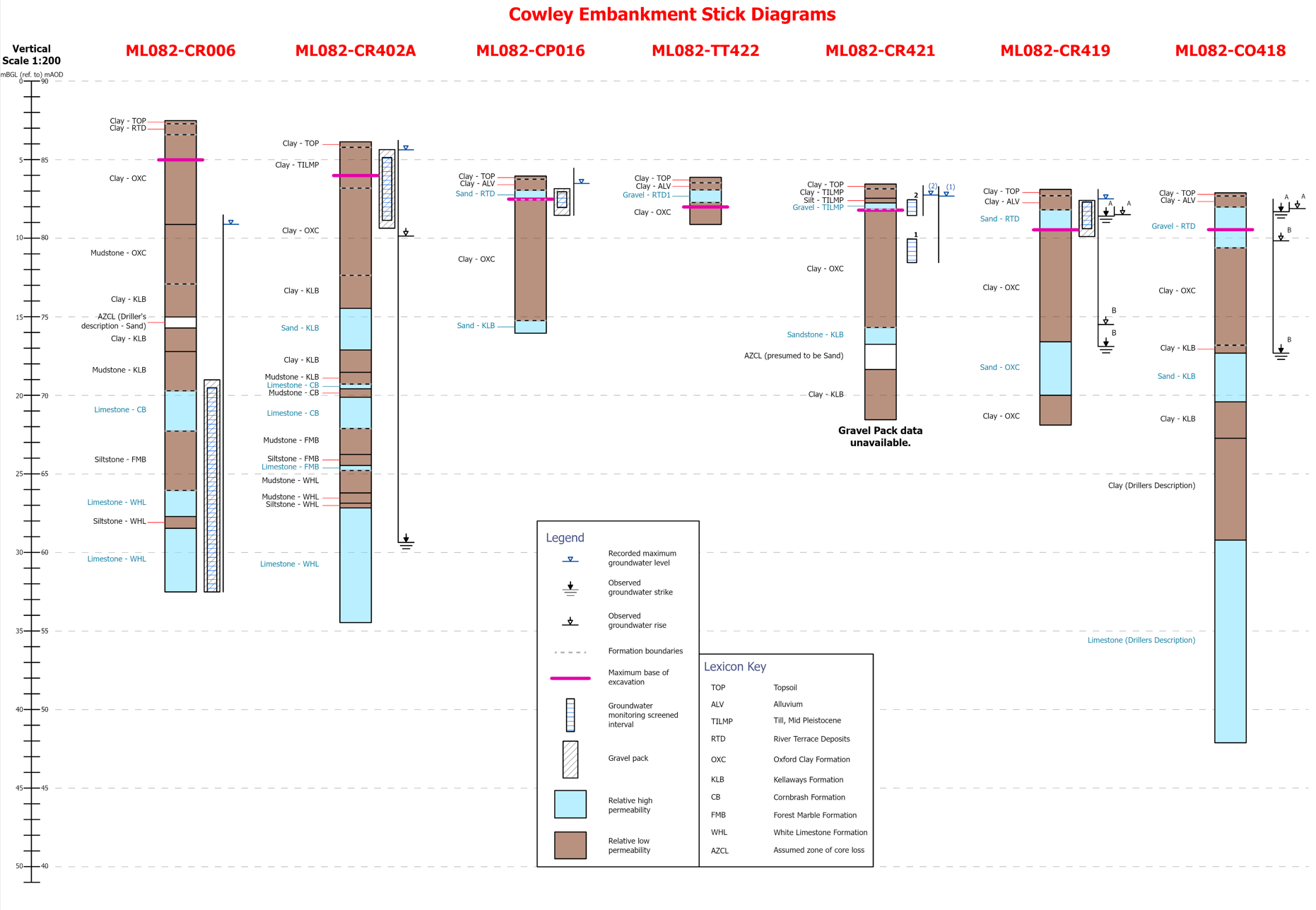
- Comprehensive management of geospatial, ground investigation, and monitoring data, ensuring geoscientific data integrity remains central to all related outputs.
- Conducting risk assessments for groundwater and surface water management.
- Ensuring compliance with Schedule 33 of the High-Speed Rail (London – West Midlands) Act 2017.
- Providing geoscientific insights and visualisations to support informed decision-making and stakeholder risk management.
- Integration of stockpile elevation and drone survey data for accurate volumetric analysis.
- Development of specialised web applications, accompanied by stakeholder training to ensure effective use.
Síor strengthened the Client’s delivery capabilities through the following solutions:
- Organisation and processing of the Client’s and stakeholders’ project data for seamless integration with Client-specific systems.
- Delivery, implementation, and maintenance of a bespoke, client-focused geoscientific hydrogeological database.
- Data management, including the organisation and integration of drone survey data and stockpile elevation data.
- Development and delivery of geoscientific insights and visualisation products, such as geospatially derived hydrological and hydrogeological web applications, permitting story maps, automated workflows for drawing production, and 3D fly-through videos.
- Quality assurance, stakeholder engagement, and training, with a strong emphasis on geoscientific data integrity and the effective use of the Field Data Collection App.
- Production of geomorphological and geospatial location assessments using georeferenced and LiDAR-derived terrain elevation models.
- Geoscientific assessments, including hydrological and hydrogeological risk assessments, GIS-based hydrological model parameterization, and multispectral land cover classification