Client: Regis Resources Ltd
Location: Western Australia
Date: 2021 – on-going
The development and management of mine water solutions is a critical component of any mining project, particularly for operations spanning large areas. Síor Consulting Australia Pty Ltd. (Síor) has been instrumental in delivering comprehensive hydrological, hydrogeological, and geospatial consulting services to Regis Resources Ltd. (Regis) for their Duketon Gold Project in Western Australia.
Síor was commissioned to support sustainable mining operations by leveraging its multifaceted expertise in hydrological and hydrogeological assessments, advanced geophysical surveying, and innovative geospatial solutions. These services were designed to ensure precision, efficiency, and long-term water resource management.
Síor was tasked with delivering a range of critical services to bolster operations for the Duketon Gold Project, including:
- Comprehensive hydrogeological assessments and preparation of legislative reports.
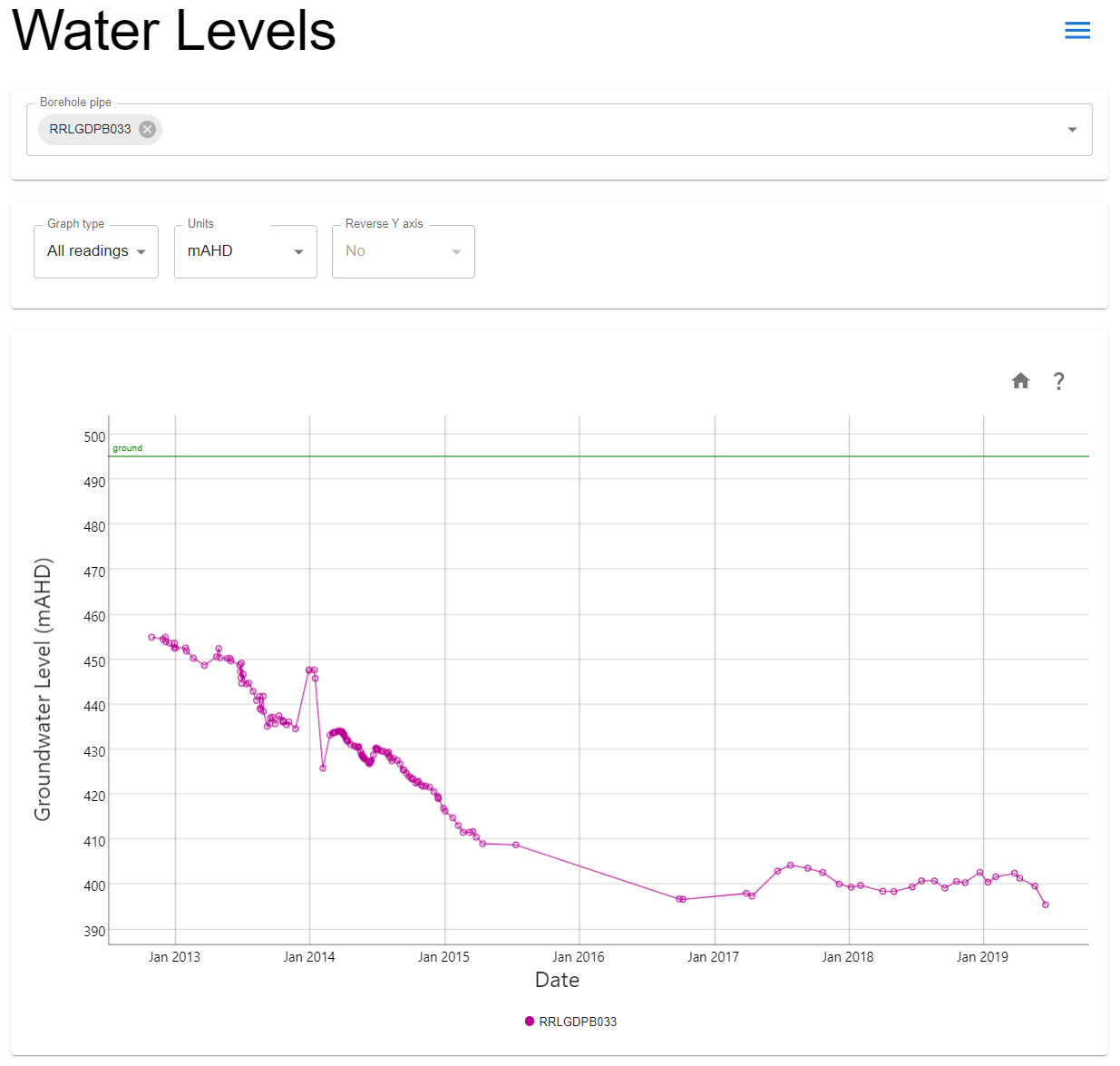
- Development and review of groundwater models and dewatering system analyses.
- Hydraulic model development and analysis.
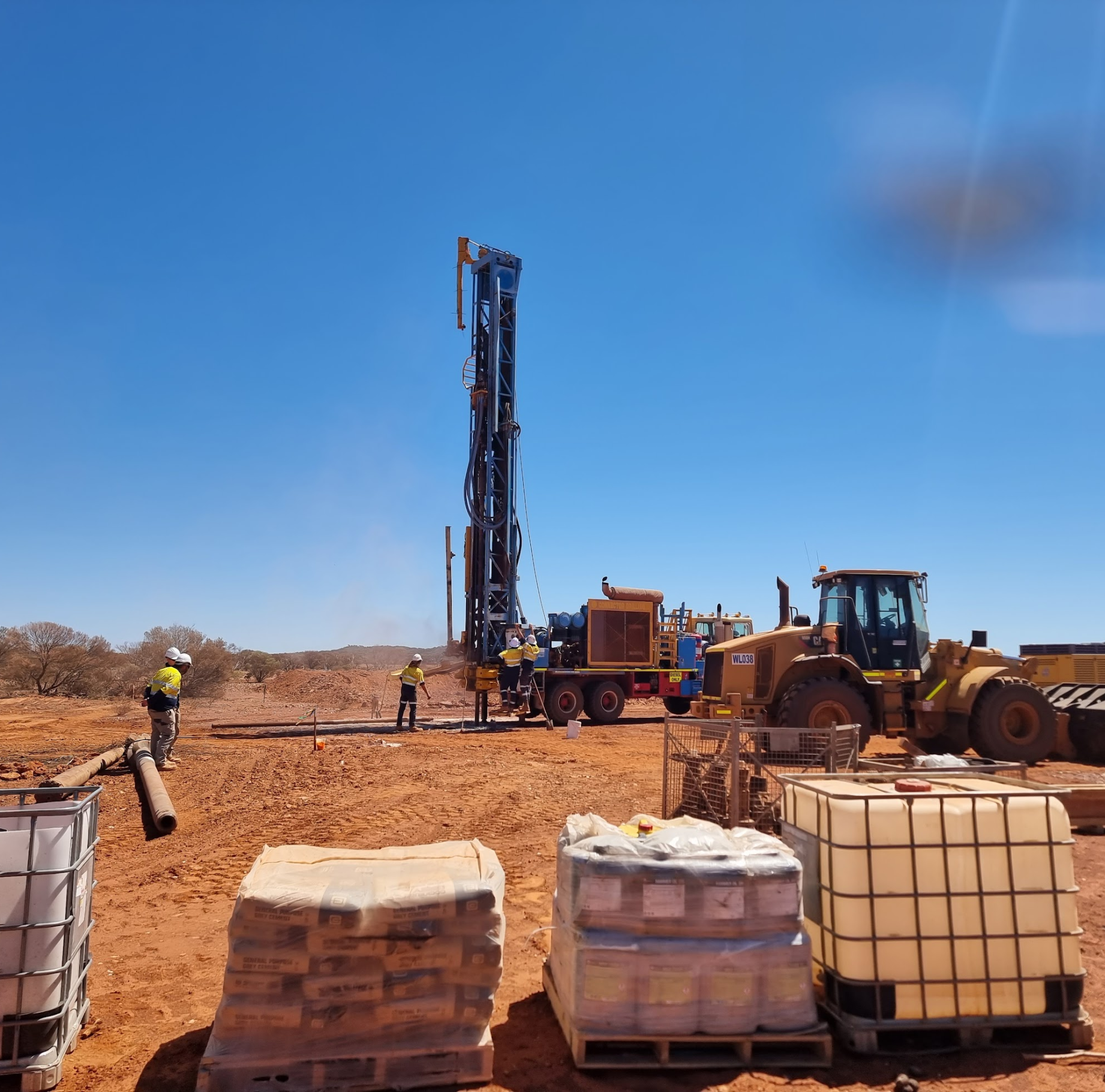
- Strategic siting of dewatering and water supply boreholes, along with supervision of subsequent drilling operations.
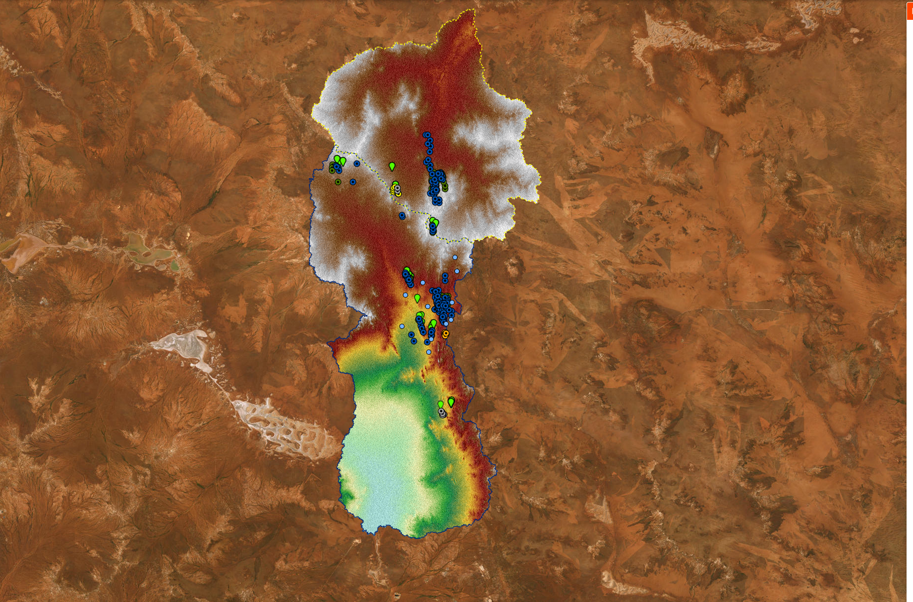
- Acquisition and analysis of geophysical survey data to provide GIS-based insights into hydrological and hydrogeological regimes.
- Conceptualisation and development of bespoke, client-centric database solutions delivered as accessible web-based applications to enhance operational efficiency.
- Ongoing ad-hoc support for the project’s operations and development needs, with a strong emphasis on sustainability.
Drawing on combined geoscientific, geospatial, and information technology (IT) expertise, Síor has:
- Executed a comprehensive, data-driven geospatial analysis to inform site-based activities and support technical works.
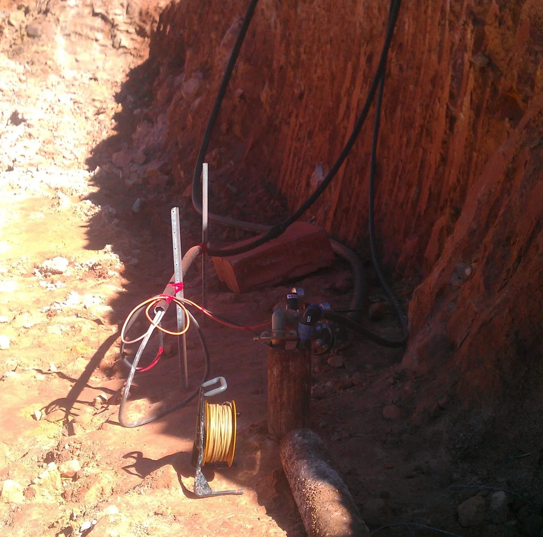
- Conducted detailed site walkover surveys and geophysical investigations, including Electrical Resistivity Tomography (ERT), to collect and interpret critical surface and subsurface field data.
- Developed and refined hydraulic, hydrogeological, geological, and dewatering models.
- Prepared and managed GIS data, culminating in the delivery of a bespoke web application for Regis Resources Ltd.
- Supervised the drilling of dewatering and water supply boreholes, ensuring thorough testing and proper development of the bores.