
Now, it’s time to get a little more personal. If you have been following this…
EAP and Evacuation Shelter Routes
Across the globe, Síor Consulting Ltd (SCL) provides tailored GIS services and solutions for clients. One of our first clients was Comak Group, Inc. (CGI). Michael Cox, CGI’s Director and now a close friend of Síor’s, recognises the importance of client and stakeholder engagement.
CGI is a multi-disciplinary engineering and environmental consulting firm serving public and private sector clients and agencies. CGI, along with its collaborative partners, provides immediate response to the needs of infrastructure improvement projects in the fields of civil, geotechnical, structural, environmental, and construction engineering.
Acknowledging that digital content must be readily assessable to create true project insights, CGI contracts SCL to collaborate on hydrological and hydraulic modelling works across the state of Florida;with seven dams successfully assessed to date, works are well underway.😊
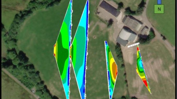
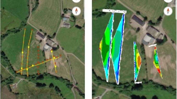
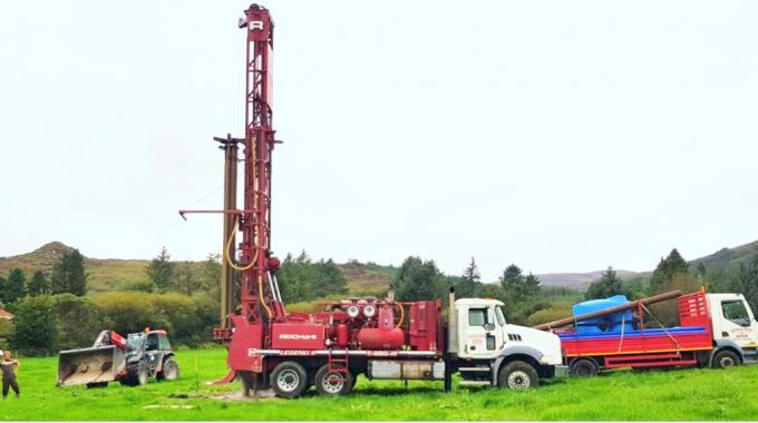
In this multi-disciplinary engineering and environmental realm, the ESRI software suite (including ArcGIS Pro, ArcGIS Online, and ArcGIS Collector App) are a power-house of spatial analysis and visualisation tools, enhancing and driving all spatial components of the project. Activities include managing environmental, terrain and bathymetric field surveying; digital terrain and bathymetric model procurement, production and merging; GIS-based hydrological modelling; and producing tailored deliverables, such as drawings and online applications.
Our collaboration on hydraulic modelling projects aims at understanding the effects of lake dam failures on downstream properties for several pre- and post-failure scenarios.
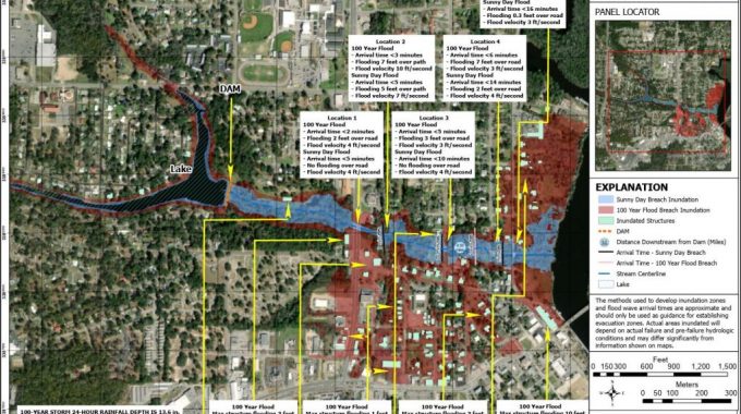
In conducting this analysis, CGI was asked to plan for the worst-case scenario, meaning coastal and key infrastructure flooding was taken account while delineating the safest and quickest routes to evacuation centres.
Below are a couple of drawings we produced for the Federal Emergency Management Agency (FEMA), following official FEMA standards. An Emergency Action Plan (EAP), shown in Figure 1, provides emergency responders with the information they need (in an accessible form) if a “Sunny Day” or “100 Year Flood” dam break events were to occur. Figure 2 shows an example of an Emergency Evacuation Routes Plan, which is disseminated to the local community.
These drawings are just two examples of a set of 60 + drawings completed for each dam project! Luckily, we have developed a set of (Python-based) tools that automate drawing production and increase our efficiency, whilst achieving consistent and tailored deliverables. Therefore, once a template is agreed with the client and stakeholders, drawing production becomes relatively quick 😊.
If you have any comments or questions, please leave a comment or send us an email. We’d love to hear from the community and are always happy to discuss.


Related Posts
Comments (0)